Outdoor fun

A Big Bend Thanksgiving – Day 3

blogsmall-3615

We had one pretty epic hike planned. A seven miler up into the high Chisos Mountains to Laguna Meadow. We woke up early to freezing temps. The leaky ice maker outside our cottage had created a slick spot of ice on the sidewalk. Gramps made the half mile walk from his accommodations to meet us and we headed out. Around 1,600 feet of elevation gain awaited us.

blogsmall-3659

blogsmall-3622

blogsmall-3775

Although it was late November, the leaf change had just gotten going in earnest. The mountains are an interesting mix of desert and forest. Among the cactus and agave are ponderosa pine and oak trees and other plants commonly found farther north in the West. Although we didn’t get to them on this hike, the Chisos Mountains are home to southernmost stand of aspen in the U.S.

blogsmall-3643

A couple hours in we stopped for a longish break for a midmorning snack. Gina, being some kind of bird whisperer, started throwing bits of peanut butter crackers on the ground and small flock of Mexican jays swooped out of the mountains and started chowing down. They nearly ate out of our hands.

blogsmall-3802

We lined up for a group photo after our snack. We should’ve stood closer to the camera.

blogsmall-3670

Gramps recommends climbing trees whenever possible. Especially when you’re 4 miles up a mountain in one of the most remote areas of the country with no real hope of timely medical intervention should you fall and crack open your skull.

blogsmall-3674

We did a lot of lolly gagging so it took us about 4 hours to get to Laguna Meadow. We thought it was pretty funny that there was a weird pit toilet up there. The trail gets a lot of traffic. Many, many groups of hikers passed us on the way up. Most were headed to the South Rim of the Chisos to camp for the night. Some groups planned to make a day trip out of the 13 mile round trip South Rim hike. We saw a man and woman in basically street clothes who said they were doing that. The woman had one of those mesh backpack purse things with the strings for straps with 2 bottles of water in it. I imagine they wanted to kill each other when they got finished.

blogsmall-3729

On the way back, just as the trail started downhill, Gramps broke off and scrambled up the southern peak of Ward Mountain. I soon followed him up there and got what must be the second best view of the Basin.

blogsmall-3725

blogsmall-3744

Views of Casa Grande from Ward Mountain. The top of Casa Grande is the best view of the Basin.

blogsmall-3745

We paused in the howling wind atop the mountain to take a bunch of photos.

blogsmall-3759

Gramps, ala Vanna White, pointing out Emory Peak, the highest point in the Chisos.

blogsmall-3740

Gramps isn’t afraid to do what it takes to get the shot.

blogsmall-3770

blogsmall-3531

One of my favorite things to do in Big Bend NP is to hit the visitor center in the Basin and check out the map of recent bear and mountain lion sightings. It’s hard to make out in the photo, but there were two sightings of a group of three mighty pumas at Laguna Meadow the week before our hike.

blogsmall-3807

The hike took way longer than any of us expected. Gramps thought we’d be back around noon. It was closer to 4 p.m. We were starving and looking forward to eating at the Starlight Theater outside the park in Terlingua Ghost Town. The ghost town is small area of ruins from the area’s mining days with a big gift shop, bed and breakfast accommodations and a few restaurants. It’s always packed with tourists and locals having a big time. The waits are long for the restaurant but there’s enough to do that you don’t really notice.

blogsmall-3813

blogsmall-3529

Day of the Dead items are a big component of the souvenirs at the gift shop.

The Fog

_D6H5169blogsmall

On Saturday we took off on one of our daylong drives and found ourselves high in the Ozarks in Pope County. Once we hit a certain elevation – about 1,800 feet – we were inside the clouds. Thick, wet clouds. The fog was thick that I got pretty freaked out driving on serpentine Highway 7. You couldn’t see the oncoming vehicles until they were about 60 feet away. I just kept imagining a big-ass truck appearing out of the fog across the centerline in my lane.

_D6H5177blogsmall

We crossed over Pilot Mountain on our way home and I stopped a few times to get some snaps of the fog.

Falling Waters

_D6H3013blogsmall

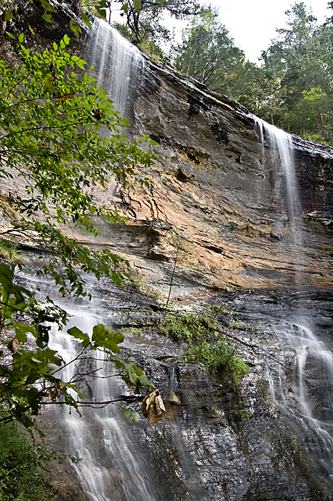
Arkansas had some uncharacteristically heavy rains in early August, making the waterfalls run at a time of the year when even decent-sized rivers are generally down to a trickle. Gina and I had a day when Abby was occupied elsewhere and ran up to Falling Water Creek to check out the high water. We checked in with Fuzzy Butt Falls, a waterfall I had not been to. The fall is in a small canyon on a small tributary of Falling Water Creek and is a beautiful spot.

There’s A Ladder With a Bucket On It … Get It?

_D6H1508blogsmall

Dad and I stood a few dozen yards from the creek bank looking at the worse-for-wear ladder with the metal bucket hanging from it and speculated on how such a configuration might have come about. The ladder had been there for awhile for sure. Vines of what appeared to be poison ivy entwined along and around the two remaining rungs. It seemed obvious that the bucket came later and we remarked that it was somewhat interesting that the bucket hadn’t already been removed by some passerby. But it didn’t seem odd that the ladder and bucket were together. Painters famously use ladders and buckets simultaneously all the time. What was odd, however, was the location of the ladder and bucket. In the middle of nowhere. In the bottom of an Ozarks box canyon miles from the nearest road of any consequence. The bucket had a single bullet hole in it, so that might’ve been a clue. Dad expanded the scope and began describing the ancient ladders he had seen still hanging high in the cliffs of the Grand Canyon. Then we continued with our hike. In an epic episode of failing to put two and two together, we totally missed the significance of the bucket hanging from the ladder.

The Creek Was Angry That Day, My Friends …

longpoolpanoblog

… like an old man trying to send back soup in a deli.

I had been to Longpool Falls in Pope County north of Russellville back in January, but I didn’t get any photos worth looking at. So when a huge deluge hit that part of the state on Friday I decided to go back and see it when it had something to show. When I got up at 7:30 a.m. Saturday the rain had made it to Little Rock, but it was still raining in Pope County. I drove through torrential rain all the way there and the rain the didn’t stop. The top photo is a two-frame panorama of Longpool Falls and the ravine downstream.

Can’t Beat A Rainy Day For A Good Hike

dsc_9342blog

When I woke up at 7:30 a.m. Sunday, the sky was clearing after a night of off and on rain and I was so bummed I almost just went back to sleep. I hadn’t gone to sleep until around 4 a.m., which made actually getting up that much harder. (I think I’ve developed insomnia.) Sunny skies spell poor conditions for shooting waterfalls. You need the even, reduced light of overcast skies to make that silky water effect.

But, as we will see, Lady Fortune is a fickle traveling companion.

Another Waterfall Trek

dsc_7605blog
Copperhead Falls seen from the top.

This past weekend found me making yet another journey to our summer home in Northwest Arkansas to deal with the aftermath of the Epic Ice Storm of 2009. Thankfully, I didn’t have to do any manual labor this time. I just paid a man I hired over the over phone to climb up in our once magnificent shade trees and cut down the hanging limbs. I realize hiring people over the phone to perform work the results of which you won’t see for a week is fraught with hazard but it worked out well this time.

On my way back to Little Rock, I detoured over to the Buffalo River to hike Indian Creek and see Copperhead Falls and Tunnel Cave Falls. The hike is billed as a dangerous one, but I found it less hazardous than the hike to the slot canyon on Shop Creek I took a few weeks ago. Indian Creek is actually the next drainage over from Shop Creek. An ambitious hiker could do both in one day if he started early enough.

Another Wasted Saturday

dsc_2501blog

I set out Saturday for the third weekend in a row looking for some fabulous fall foliage. I failed. In the hope that the leaves down south were still in peak form, I headed down to the Cossatot Falls State Park. As I headed down I-540, I could see the leaves in Northwest Arkansas were about done. I was hoping the foliage would get better the farther south I traveled on Highway 71. I was disappointed. Plus, the area I went to might not be the best for fall color anyway. The area is mostly timber company land planted in pine trees. The little swirly parts in the photo become raging whitewater holes when the river comes blasting through after heavy rains. The river is typically low in the fall. On Saturday, you could have easily waded across without a problem. Cossatot is supposedly an Indian word that means skull crusher. They say this is the most challenging whitewater in Arkansas.